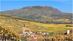
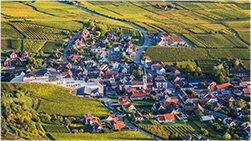
KUGELBERG DE RORSCHWIHR
ID CARD
- SURFACE : 7 hectares 57 ares 58 ca
- NATURE DU SOL : Conglomérats calcaires et marnes interstratifiés
- ERE : Tertiary
- PERIOD : Paleogen
- PERIODS : Upper Eocene and Oligocene
- FLOORS : Prabonian / Lower Rupelian
- EVENTS : Jolts during the paroxysmal phase of the collapse of the Rhine ditch
- AGE : – 37 to – 31 Million years
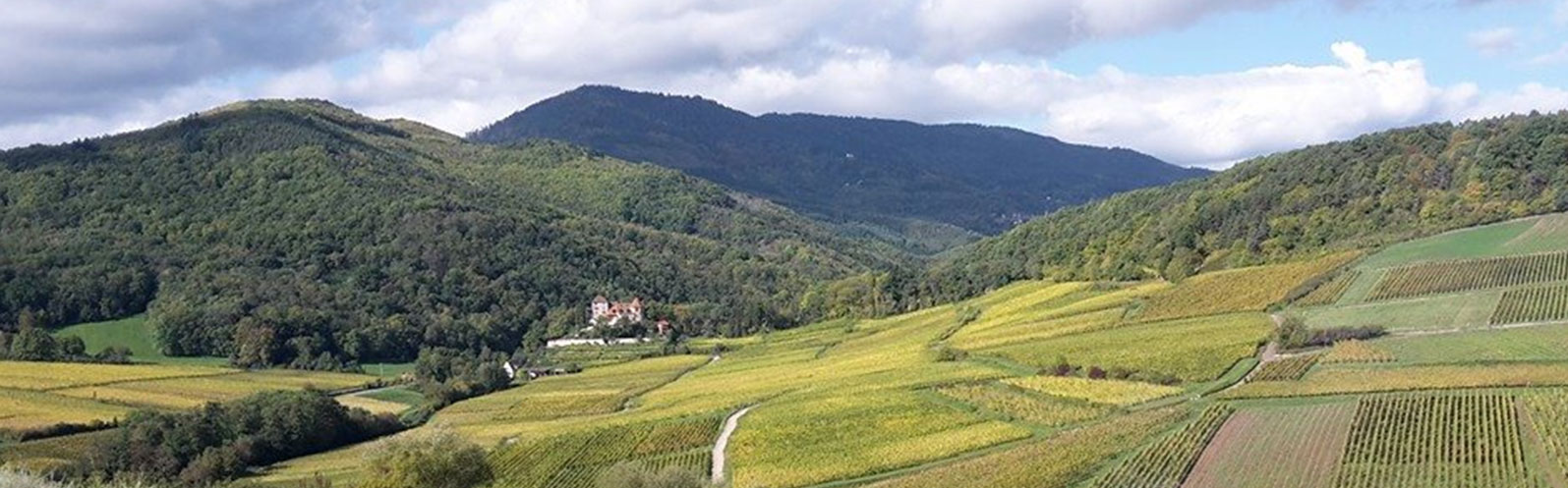
- ALTITUDE : 245 – 290 meters
- EXPOSURE: South and East
GEOLOGICAL CHARACTERISTICS
This tertiary “coastal” conglomerate is different from that of Grasbergde Rorschwihr or Stegrebende Rorschwihr. Indeed, it contains pebbles of sandstone limestone from the lower Dogger (upper Aalenian) which outcrops upstream; this sandstone, ferruginous, brick-red, often oolitic limestone is always rich in iron oxides which are found to be very resistant to erosion. This typical facies, relatively fossiliferous in ammonites (Ludwigia murchisonae and Ludwigella concava) and lamellibranchs is often reworked into large blocks or slabs in the conglomerate. On the north-eastern flank of the Kugelbergde Rorschwihr, the conglomerates contain limestone pebbles from the lower Lias (Sinemurian). This shows that erosion had already reached this level after having cleared the Bajocian, then the Aalenian and the Pliensbachian. These conglomerates based on lower Lias are therefore younger than those built solely on the basis of Oolitic Dogger (principle of reverse sedimentation). These conglomerates with altered liasic fauna: grypheas, rostrums of Belemnites, ammonites (Amaltheus, Pleuroceras) and nodules or ferruginous debris of ovoid marls, are located below the land of Lias, at the northern end of Kugelbergde Rorschwihr. In the whole of the Kugelbergof Rorschwihr, it is nevertheless the limestone pebbles of the Grande Oolithe du Dogger (Bajocien) that predominate. The source rock outcrops at the top of the Kugelbergwhere the fissured karstic limestone beds, altered on the surface, support veneers of the siderolithic Eocene (lower and middle Eocene). These remains of associated continental ferruginous deposits, or freshwater limestone media, are very rare. They are the result of Cretaceous-Tertiary tropical climate change.
This geological overview is taken from a private study carried out by the INSTITUT DE GEOLOGIE DE L’UNIVERSITE LOUIS PASTEUR DE STRASBOURG (Claude SITTLER and Robin THIRION) at a scale of 1/5000 on behalf of DOMAINE ROLLY-GASSMANN.
ABOUT THE PLACE-DIT
This locality was mainly exploited by the monks of Moyenmoutier and by the Convent of Sélestat which mentions it, for the first time, in 1348. The translation of its name means “mountain ball”. This name can no doubt be explained by the presence of granular ferruginous concretions (Bonherz from the lower Eocene lining with limestone karst from the Dogger) which are reminiscent of balls or pellets from the first firearms. Completely anecdotal, it should be noted that the Kugelbergis marketed and claimed on various harvest declarations see the 300 harvest declarations of Rorschwihr which mention the 12 localities. It should be noted that Rorschwihr only has 5 handlers, 2 of whom do not have vines in the 12 localities of the Municipality, the other winegrowers being either cooperators or vendors of grapes).
SOME GRANDS-CRUS WITH RELATED GEOLOGICAL CHARACTERISTICS
(cf. “Landscape units and subsoils of the Alsatian vineyard – Cartography at 1/25000” – 1990)
Altenberg de Bergheim (east), Altenberg de Wolxheim (east), Bruderthal (locally), Eichberg (center), Engelberg (center), Florimont (top), Furstentum (east-top), Goldert (center), Hatschbourg (west) , Pfersigberg (east), Rosacker, Steinert (north-west), Steinklotz (west), Zinnkoepfle (locally), Zotzenberg (east)
15 Grand Rue 68590 Rorschwihr
at 6 p.m. from Monday to Saturday and the second
and fourth Sunday of each month of
10 a.m. to noon and 2 p.m. to 6 p.m
et vins
en ligne

dans le monde
vidéos